


The U.S. Just Expanded Its Territory by a Million Square Kilometers Without Any Treaty
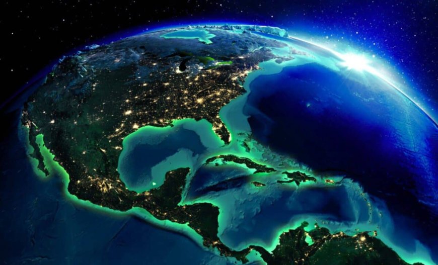
The United States quietly expanded its physical territory by one million square kilometers in late 2023, an area roughly twice the size of California. The addition, announced by the State Department on December 19, gives the U.S. sovereign rights over vast stretches of seabed across seven offshore regions, from the Arctic to the Gulf of Mexico.
This isn’t new land above water. It is the outer limit of the U.S. continental shelf beyond 200 nautical miles from the coast, a zone known as the Extended Continental Shelf, or ECS. Under international law, coastal nations that can prove their seabed naturally extends beyond that standard limit gain control over everything on and beneath the ocean floor, according to the State Department’s official ECS page.
More than half of the newly claimed territory lies in the Arctic. The rest spans the Atlantic coast, the Bering Sea, the Pacific coast, the Mariana Islands, and two areas in the Gulf of Mexico.
The Arctic Overlap: Four Nations, One Seafloor
The Arctic Ocean seabed is becoming crowded. Russia, Canada, Denmark (via Greenland), and the United States all have overlapping claims to the same underwater real estate. Russia has been particularly aggressive. In 2007, two Russian minisubs planted a titanium flag on the seabed at the North Pole, a stunt that infuriated other Arctic nations.
Russia’s claimed area now covers about 2.1 million square kilometers. The U.S. claim in the Beaufort Sea, which stretches north from Alaska, overlaps with Canadian claims, setting the stage for future negotiations.

“The government of Canada will continue its efforts to obtain international recognition of the outer limits of Canada’s extended continental shelf,” a Canadian Foreign Ministry spokeswoman said. “Canada and the U.S. are in frequent communication with regards to the continental shelf in the Arctic.”
How the U.S. Gamed the System
Here is where it gets legally creative. The United States has never ratified UNCLOS, the 1982 treaty that established the ECS rules. The Senate has considered the treaty multiple times since 1994 but never given its advice and consent. A detailed Congressional Research Service report from January 2026 outlines the full history.
Despite that, the U.S. spent nearly two decades and more than 100 million dollars collecting geological data to define its ECS limits using the exact formulas laid out in the treaty. Then, in December 2023, the State Department simply announced those coordinates without submitting them to the UN commission for review, as treaty members must do.
“It was a very unconventional and surprising move,” Rebecca Pincus, director of the Polar Institute at the Wilson Center, told Radio Free Europe. “The U.S. has claimed a million square kilometers of territory, which is great, but we have done so in a way that raises some questions about international law.”

The advantage is clear. Treaty members who mine their ECS must pay royalties to the International Seabed Authority. The United States, as a non-party, does not. “Apparently America can have its cake and eat it, too,” The Atlantic wrote in January 2025.
“This erodes credibility of an international system the West has worked tirelessly to achieve, promote, and protect,” Elizabeth Buchanan, an expert on polar geopolitics with the Modern War Institute at West Point, told RFE/RL.
What’s Actually Down There: Trillions in Resources
The newly claimed seabed is not empty. The Bureau of Ocean Energy Management estimates that undiscovered, technically recoverable oil resources on the entire U.S. Outer Continental Shelf total 65.8 billion barrels, with natural gas at 218.4 trillion cubic feet. The breakdown: Alaska holds 24.1 billion barrels, the Gulf of Mexico 26.9 billion, the Pacific 10.3 billion, and the Atlantic 4.5 billion.
BOEM Acting Director Matt Giacona said the U.S. Outer Continental Shelf holds “tremendous resource potential.” The Arctic alone could contain 90 billion barrels of oil, according to a 2008 U.S. Geological Survey report.

Beyond oil and gas, the seabed holds minerals critical for electric vehicle batteries: manganese nodules, ferromanganese crusts, and polymetallic sulfides. The State Department has said the combined area could be worth trillions of dollars.
Scientific Discoveries Hidden in the Mapping
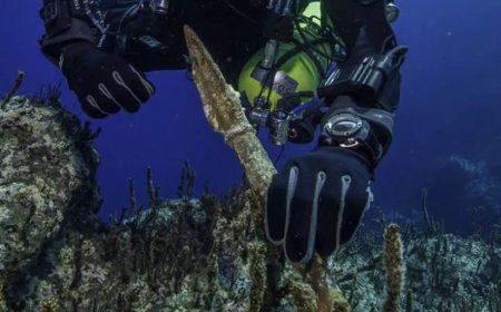
The 20-year mapping effort, the largest offshore mapping project the United States has ever undertaken, made genuine scientific discoveries.
In the Atlantic Ocean, seismic data revealed the Cape Fear submarine landslide, a 375 kilometer long (233 miles) underwater avalanche and the largest ever documented off the U.S. east coast. In the Arctic, researchers mapped scrapes on the seafloor made by ancient glaciers and pockmarks created by exploding gas.
NOAA mapped more than three million square kilometers of seafloor in U.S. coastal areas during the project, an area larger than Alaska, California, and Texas combined. The effort also determined the precise depth of the Challenger Deep, the deepest spot in the ocean, at 10,994 meters (36,070 feet).
“We’ve established the limits of the U.S. continental shelf, and it’s now up to us to explore, learn new science, and then steward, manage, and help preserve these areas for future generations,” said Barry Eakins, a marine geophysicist who led the CIRES ECS team at NOAA.
The U.S.-Canada Arctic Partnership
Much of the Arctic data came from a five-year collaboration between the United States and Canada that ended in 2011. The joint missions used two icebreakers: the U.S. Coast Guard Cutter Healy and the Canadian Coast Guard Ship Louis S. St-Laurent.
“With one ship breaking ice for the other, the partnership increased the data either nation could have obtained operating alone, saved millions of dollars by ensuring data were collected only once, and increased scientific and diplomatic cooperation,” said Larry Mayer, the U.S. chief scientist on the Arctic mission.
Since 2003, the Healy alone has mapped more than 320,000 square kilometers (123,000 square miles) of Arctic seafloor, an area about the size of Arizona.
“These data provided high resolution maps to help determine the outer limits of the U.S. ECS, while revealing previously undiscovered mountains, known as seamounts, and scours created by past glaciers and icebergs scraping along the ocean bottom 400 meters below the surface,” Mayer said.
The extended continental shelf now officially appears on U.S. maps. On the seafloor, the United States just became a much larger nation and a much more complicated one on the international stage.
Enjoyed this article? Subscribe to our free newsletter for engaging stories, exclusive content, and the latest news.
What's Your Reaction?
 Like
0
Like
0
 Dislike
0
Dislike
0
 Love
0
Love
0
 Funny
0
Funny
0
 Angry
0
Angry
0
 Sad
0
Sad
0
 Wow
0
Wow
0